The Draw Tool

We suggest to work in EPSG:3857!
When enabled, each left mouse click adds a corner point to the polygon on the map. Close the polygon with a right click.
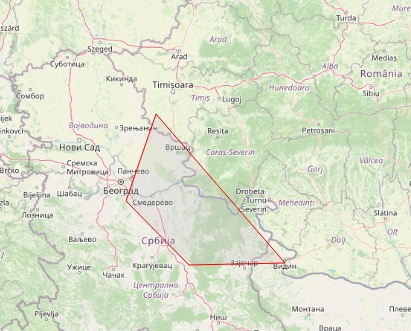
The red outline draws the survey area that will serve as a bounding box for API requests. After finishing the drawing, the found features are added to the map.
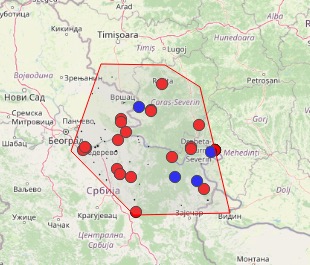
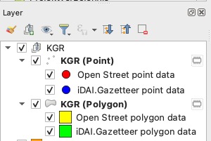
Whenever a search is performed, the KGR Finder Plugin adds a group of layers for polygons and point data. With a point and polygon Layer and two styles for iDAI.gazeteer or OSM data.